A Guide to Pittsburgh Public Transit
January 2026
If you're here, you're either moving to Pittsburgh and wondering if you can live without a car, or the kind of person that reads tax code changes for fun. Either way, I hope this post can satiate some of your curiosity. I spent 3.5 years here without a car before I caved and bought one, so I'm writing this with a mix of both love and frustration with Pittsburgh public transit.
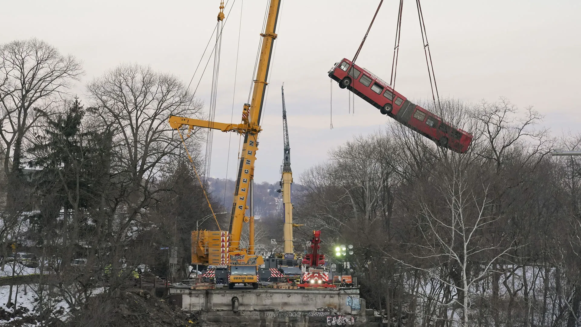
Public transit in Pittsburgh seems to be everywhere, except when you actually need it. Here it is in the collapse of the Fern Hollow Bridge:
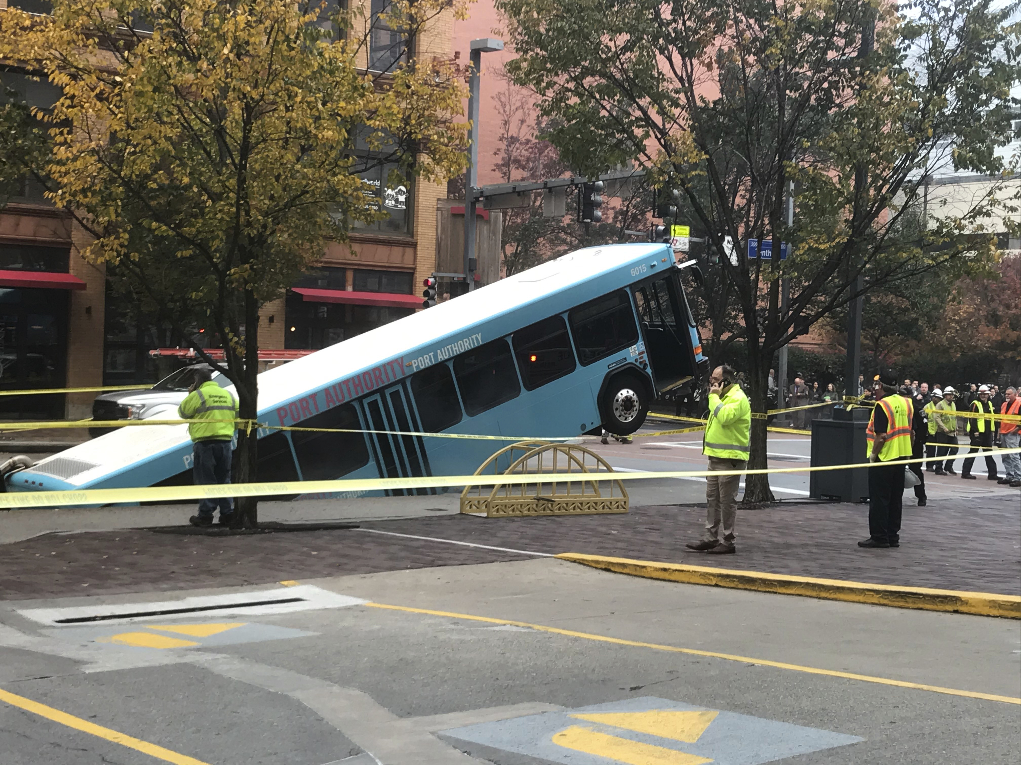
In a sinkhole downtown:
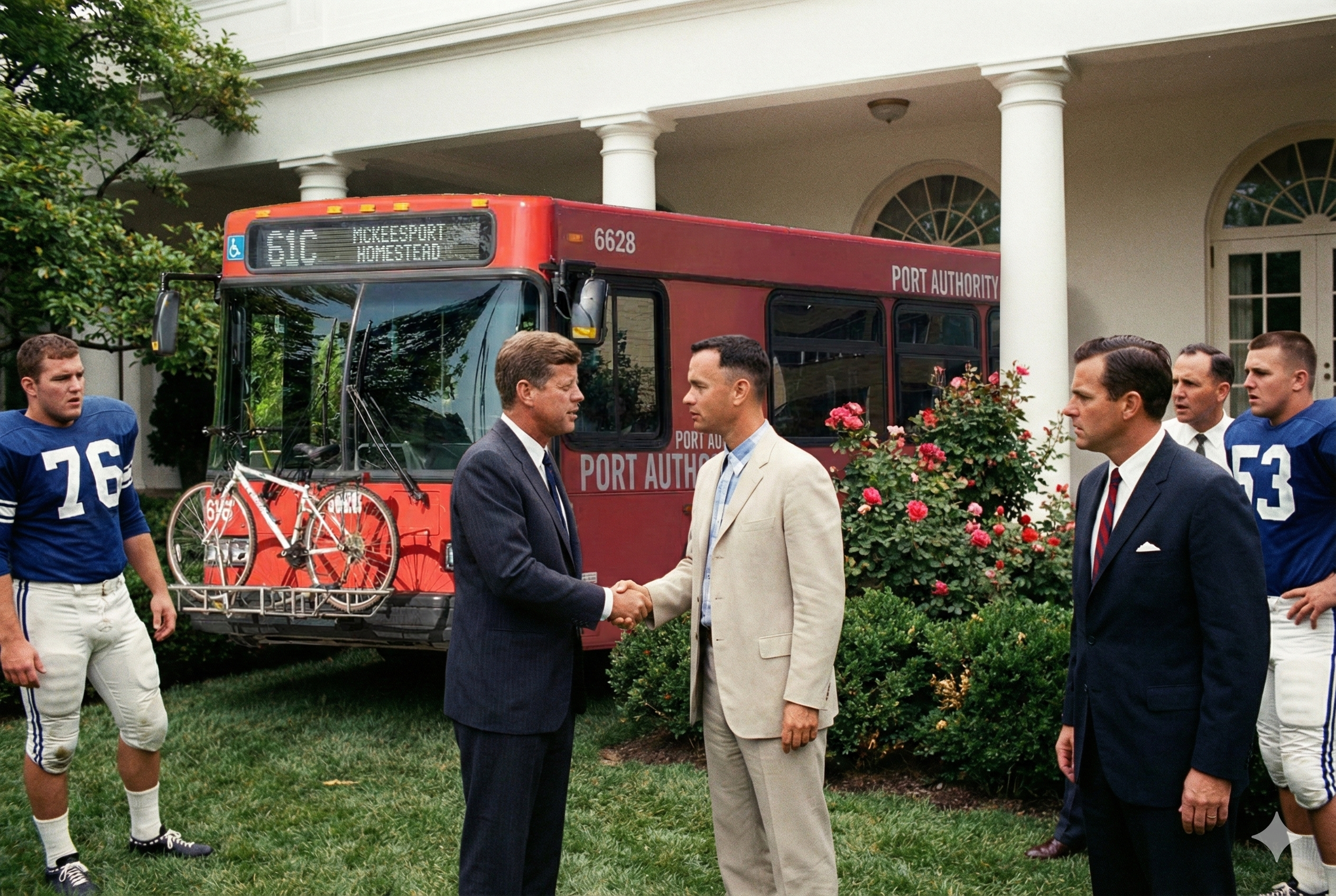
On the collegiate All-American Football Team:
Ok, I kid, but to see what I mean, take a look at the system map below. At first glance, it may seem like you could go nearly anywhere in the city without a car.
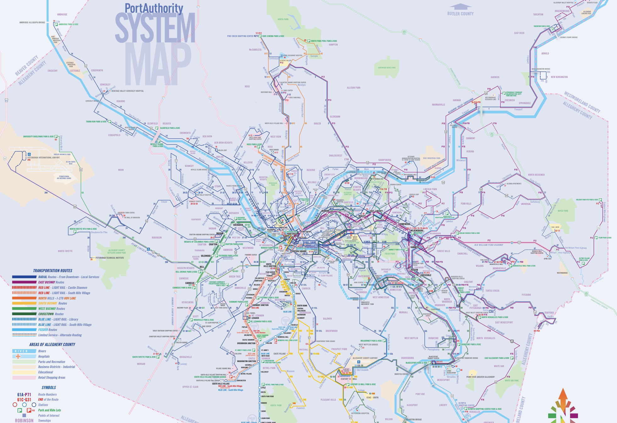
The problem is that the vast majority of these routes are run by buses, not trains, and more specifically, buses that show up every 30 minutes on average. Oh, and except when they don't show up at all, which happens regularly enough that you can't chalk it up to a rare occasion.
What does this mean in practice? To answer that question, we have to divide the city into 4 zones. In Zone 1, you can easily live without a car, while in Zone 4 you would practically be under house arrest without one.
The Zones
Zone 1: Downtown and Oakland
This zone consists of the small downtown triangle, Oakland where all the colleges are, and a couple of central Busway stops which makes it easy to get to the aforementioned two places to transfer. Most of Pittsburgh's bus and T routes converge here, which means you have options galore to get anywhere in the city.
Zone 2: Parts of the City Proper
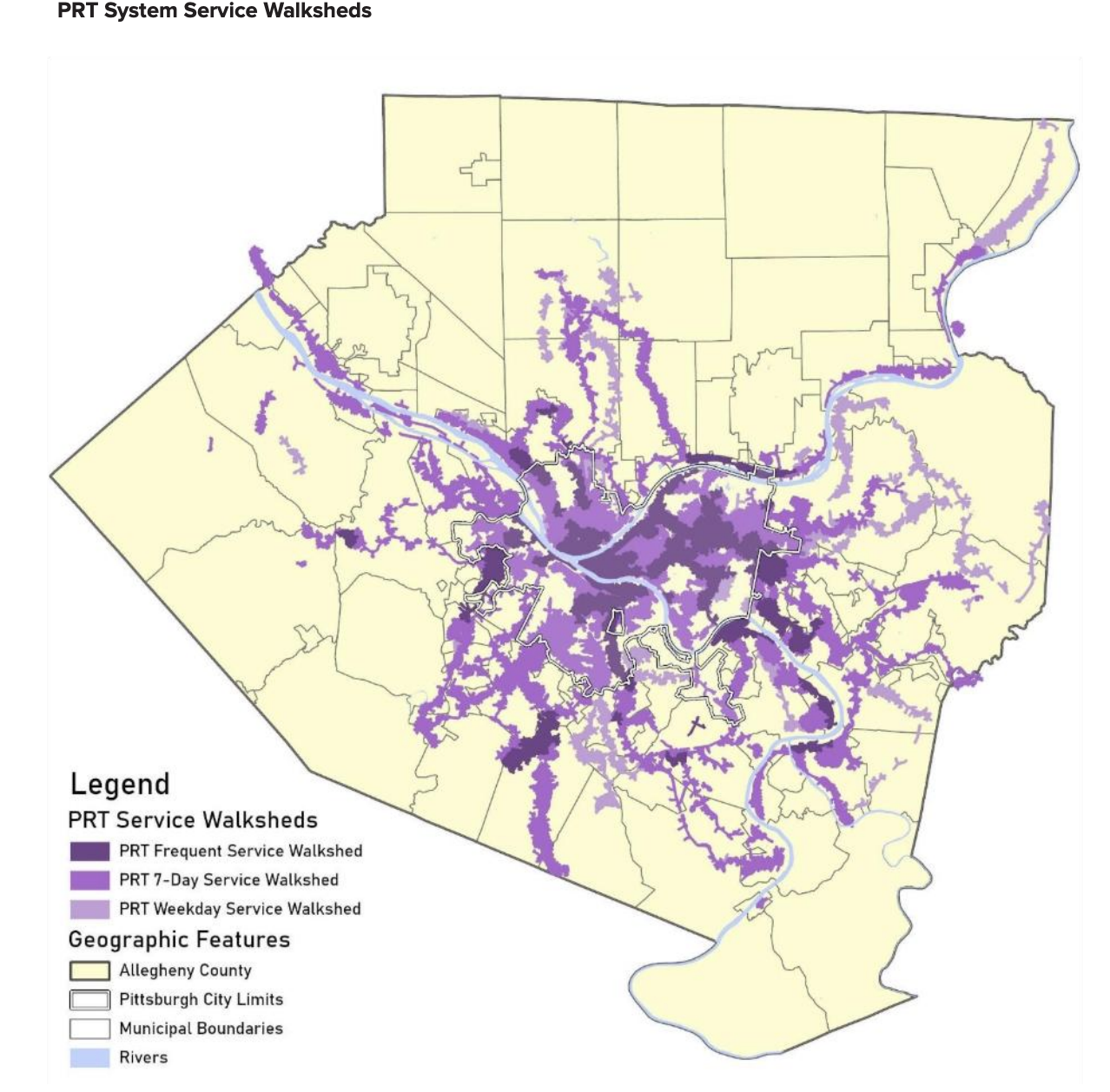
This is either (i) most places in the city proper close to major roads, or (ii) close to a T-stop. The best delineation of this zone is probably the dark purple area in PRT's walkshed map below. Most of these places have 2-3 useful routes with a 15-30 minute frequency.
If your work/school/gym/friends/grandmother are along the routes served by the buses on your street or the T, you can still live a pretty reasonable life without a car (I did for 3+ years). To get anywhere else, be prepared to walk, uber, cycle, or budget more than an hour to make a transfer to get to your destination.
Zone 3: Everywhere Else in Allegheny County
This is the light purple area in the map above. Good luck. You probably have one bus line close by. That might be sufficient for getting to and from downtown, but be prepared for times when the bus decides not to show up. Getting anywhere else requires a PhD in route planning, oodles of spare time, and some degree of intrepidness.
Zone 4: The Rest of the Pittsburgh Metro Area
This is the uncolored region of the map. Most of it is classic American suburbia. To put it bluntly, find a new house if you need to rely on public transit to get anywhere.
The Cast of Characters
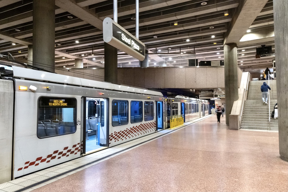
With that out of the way, here's a 20,000 foot view of the main modes of transportation that make up Pittsburgh's public transit system.The 'T'
This is Pittsburgh's light rail system. Outside of a small chunk of Downtown and the North Shore, this mostly serves suburban commuters in the South Hills who want to get to downtown and back. In all my years here, I've had reason to take it a couple of times at most, which might say something about its reach (granted, I may not be the target audience). The 'T' does serve downtown and the North Shore, where it is mildly useful to get to the stadiums, Science Center, and Casino, free of charge!
It does deserve some brownie points for adding to the overall aesthetic of the city. Are we even a proper city if we don't have some rail?
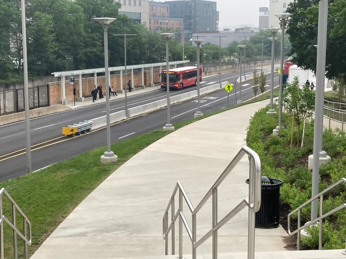
The Busways
This is the most criminally underrated aspect of Pittsburgh's public transit system in my opinion. Busways are access-controlled routes used exclusively by public buses and some emergency vehicles. The bus stops on these routes are train-station like, and a bus usually arrives every 5-10 minutes in rush hour. These are some of the few routes where taking a bus is genuinely much faster and more convenient than driving. It's sad how many people I know living nearby who don't know this exists and rely on Ubers to get downtown when they could get there much faster for less than 3 bucks.
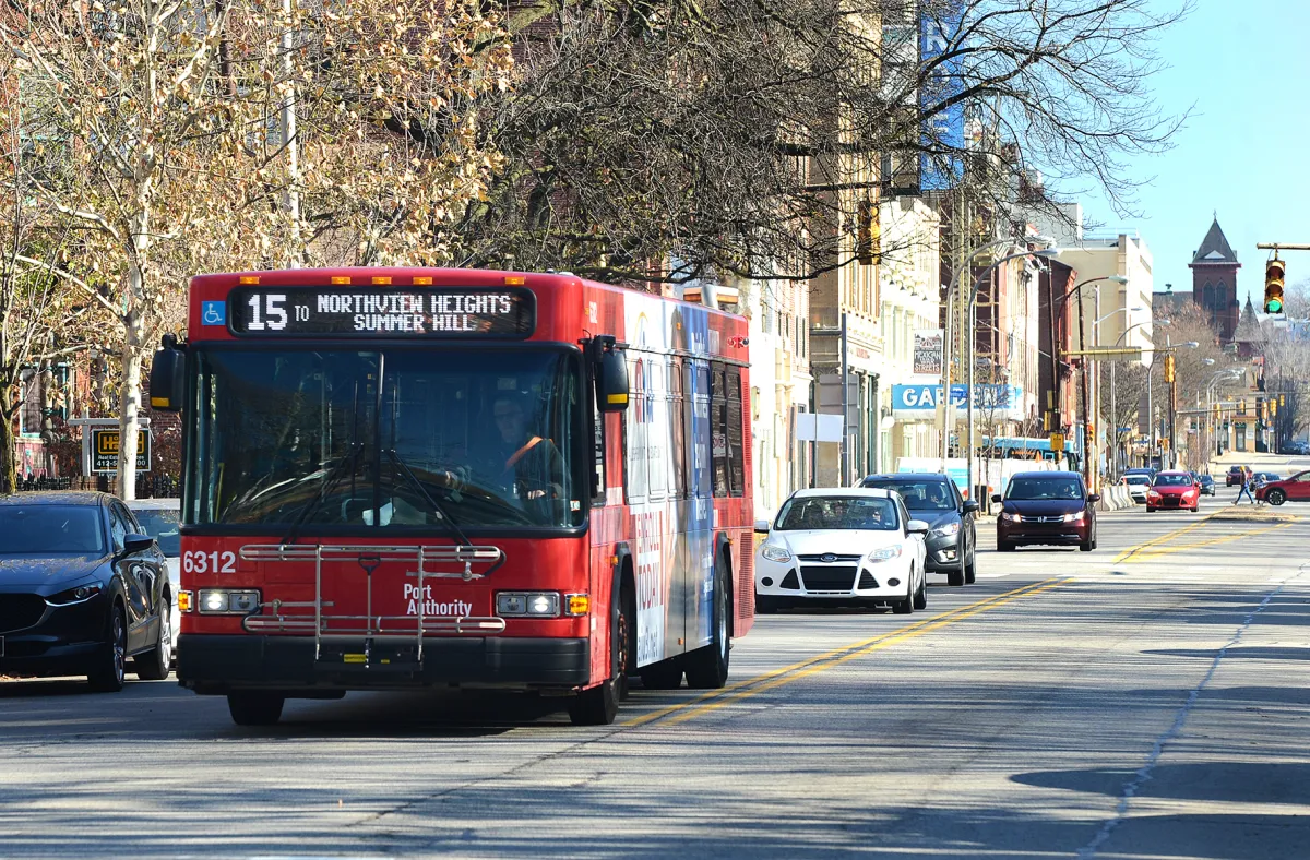
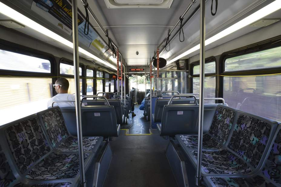
The Buses
The workhorse of the transit system. They are usually pretty tidy - for anyone needing a frame of reference, buses here are miles cleaner than the New York Subway, but not as spic and span as Singapore or Tokyo's buses. You can almost always get a seat except for a few routes in Oakland and on the Busway during rush hour.
I've taken buses at all hours of the day and night, and I've always felt safe, with the big caveat that I am a 20-something man. The most 'entertainment' I've experienced is hearing the ramblings of the rare drunk person, though they usually keep to themselves. Drivers tend to be pretty strict about not letting disruptive people on the bus and at stopping anyone who doesn't make an attempt to pay.
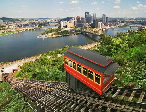
The Inclines
Once upon a time, Pittsburgh had more than ten functioning inclined railways. Today, there are only two, about a 10 minute walk apart from each other. These days, they are mostly used as a novelty for tourists, who can ride them ~400 feet up Mount Washington to get a view of the skyline while looking like they are in a Wes Anderson movie. I have heard that some residents of Mount Washington do still use the Inclines for their daily commutes - I'd be curious to meet someone who actually does.
Taxis and Rideshare
Not technically public transit, but you will have to resort to these at times. For the unacquainted, Pittsburgh does have both Uber and Lyft. I live in the east end, and can almost always get a ride within 10 to 15 minutes. The only time I have had delays is with booking airport rides in the wee hours of the morning - drivers don't like taking these because there are no flights that land at that time to get passengers back. In those cases, you can also try to pre-book a traditional taxi from a company like Z-Trip.
Waymo has started testing in Pittsburgh as of late 2025, and I estimate they'll start public rides by early 2027. I certainly look forward to more competition in this space!
Route Planning
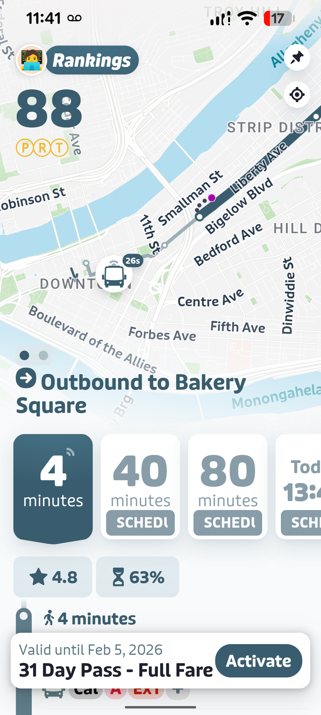
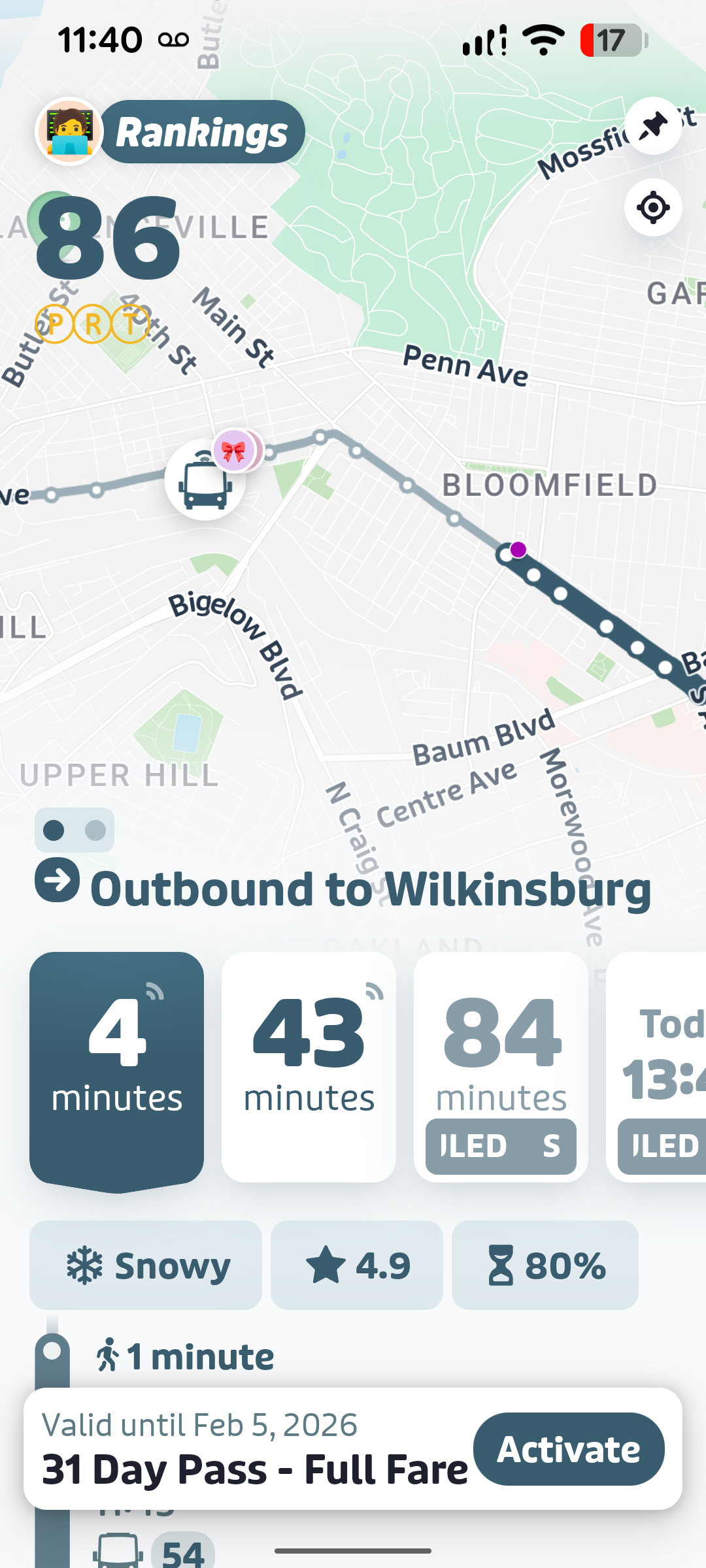
Transit App
This should be your go-to app for figuring out which buses to take and when they're arriving. The free version only shows you 3 lines at a time, but you can move the location pin around slightly to try and get different buses to show up (or just pay 5 bucks for the damn thing).
Bus arrival times are colored differently based on the data source. If the time is in muted grey, it means the app is showing you PRT's published schedule instead of real-time data. This either means the tracker on the bus is missing, or that the bus itself won't be arriving. I've found it to be a 50/50 between both cases.
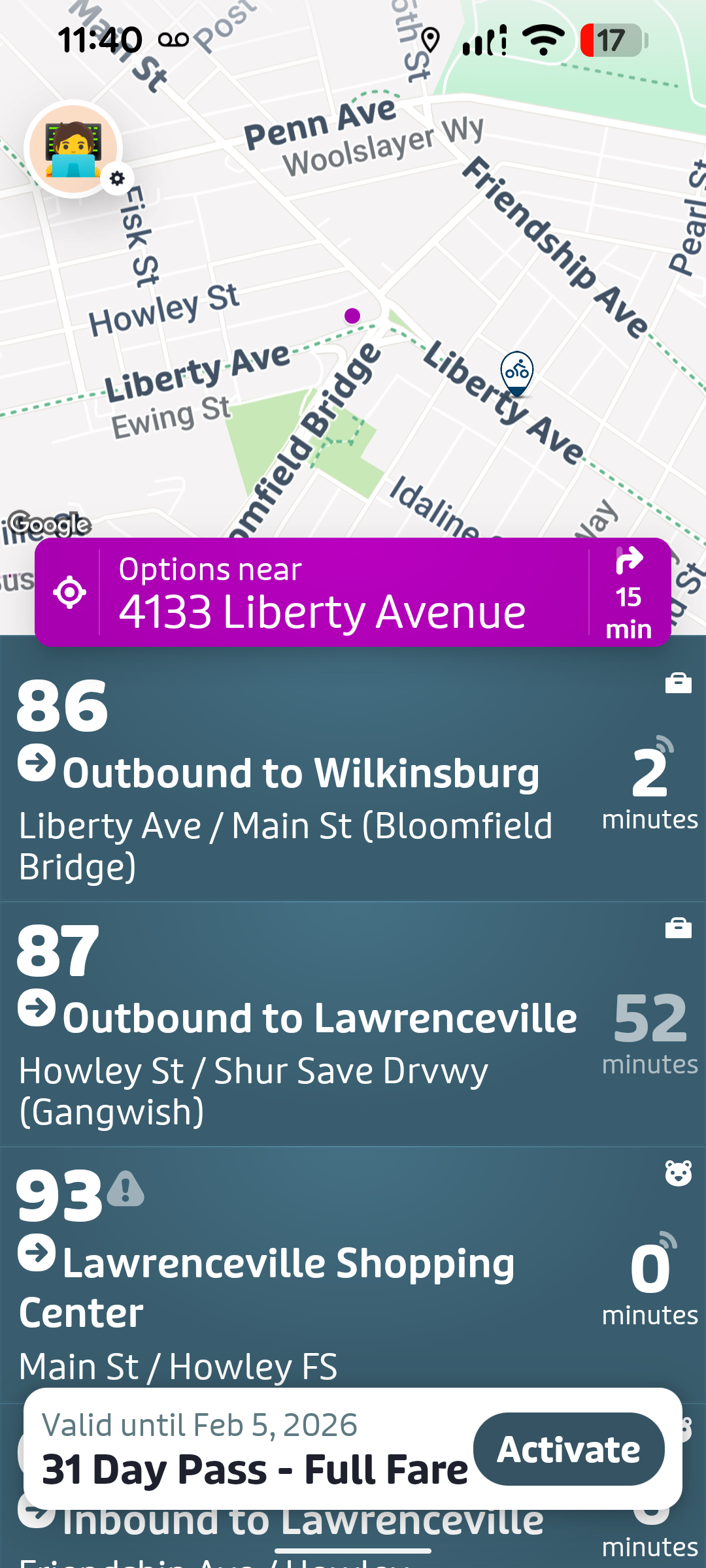
If the arrival time is a pulsing white or blue indicator, this means the data is coming from the bus's GPS tracker. Pro-tip: click on the bus line to actually view the position of the bus, and make sure it's moving. If you don't actually see the position of the bus, or if it's not moving, this probably means the tracking is broken. For loop lines, you might have to look at the opposite direction of the line to view the position of the bus, in case it's still completing its previous leg.
If you click to see a bus's position and you see an 'emoji' or two on the bus, this means the location is being crowd-sourced by Transit users on the bus. This can be helpful if the bus's tracker is broken, although it can occasionally be inaccurate if the person helping to crowd-source the information gets off the bus.
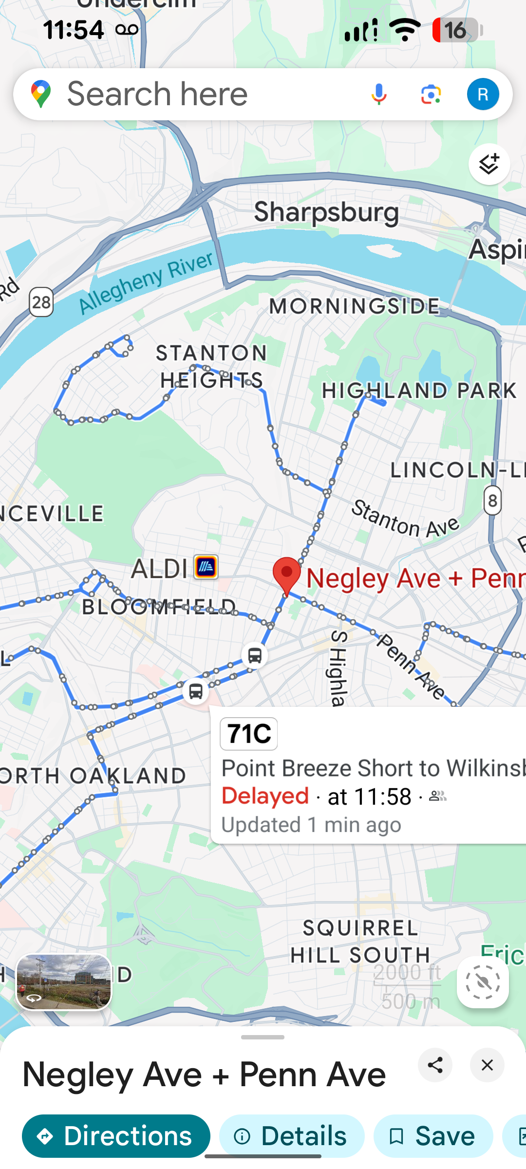
Google Maps
This serves almost the same information as the Transit app, but I find that it is just a little less public transit-friendly. For example, you can zoom in to a road and click on a nearby bus stop icon to see arrival times, but the process is cumbersome. It also lacks any crowd-sourced data about bus arrival times. Another minor annoyance is that it doesn't show a bus that has just left the bus stop, unless you select a bus stop further along the route.
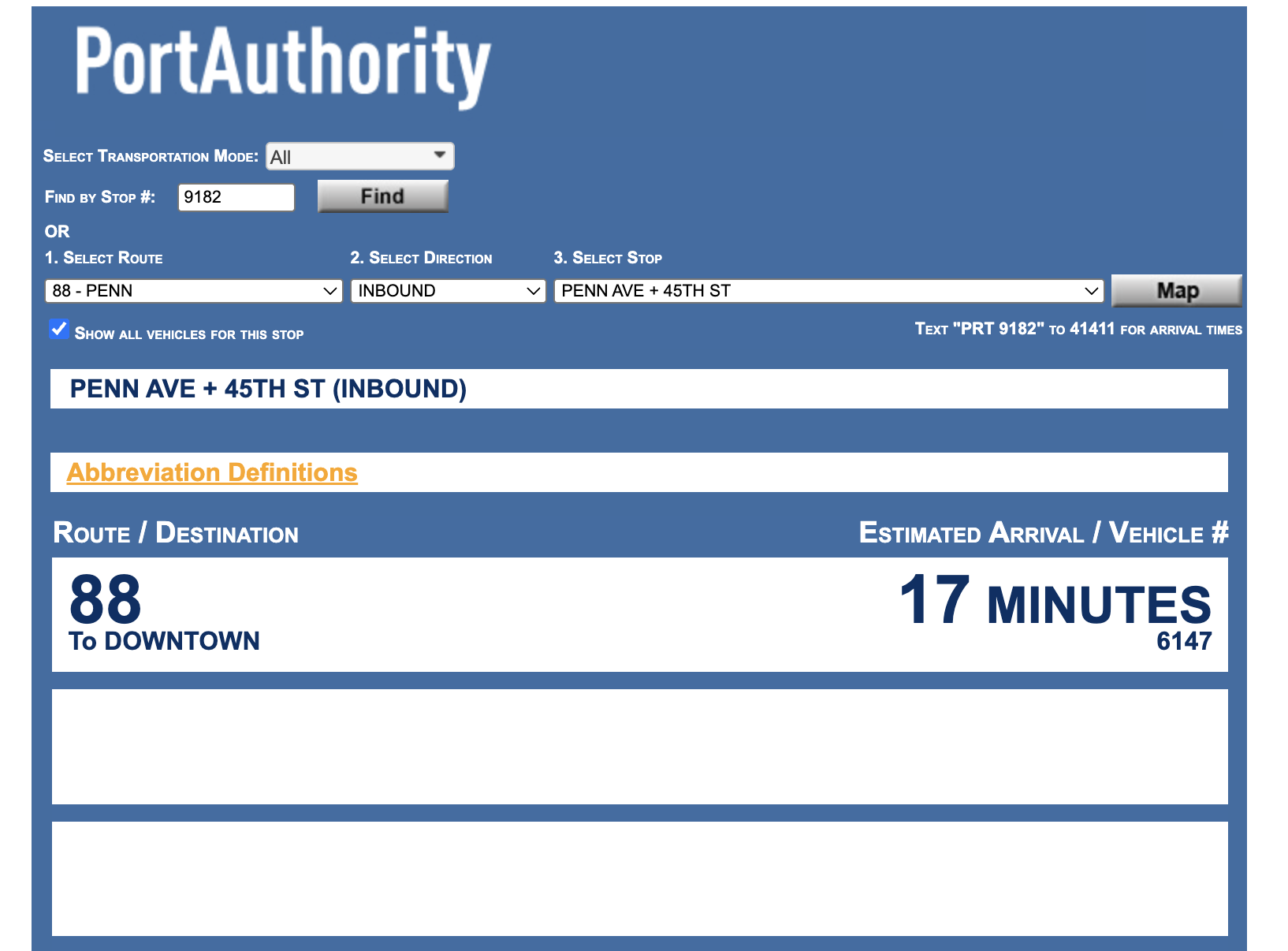
PRT TrueTime
This has the same information as the transit app, but in a 90s-chic web interface. Use this if the other apps are down, or if you are a hipster who shuns mobile apps and dynamic webpages.
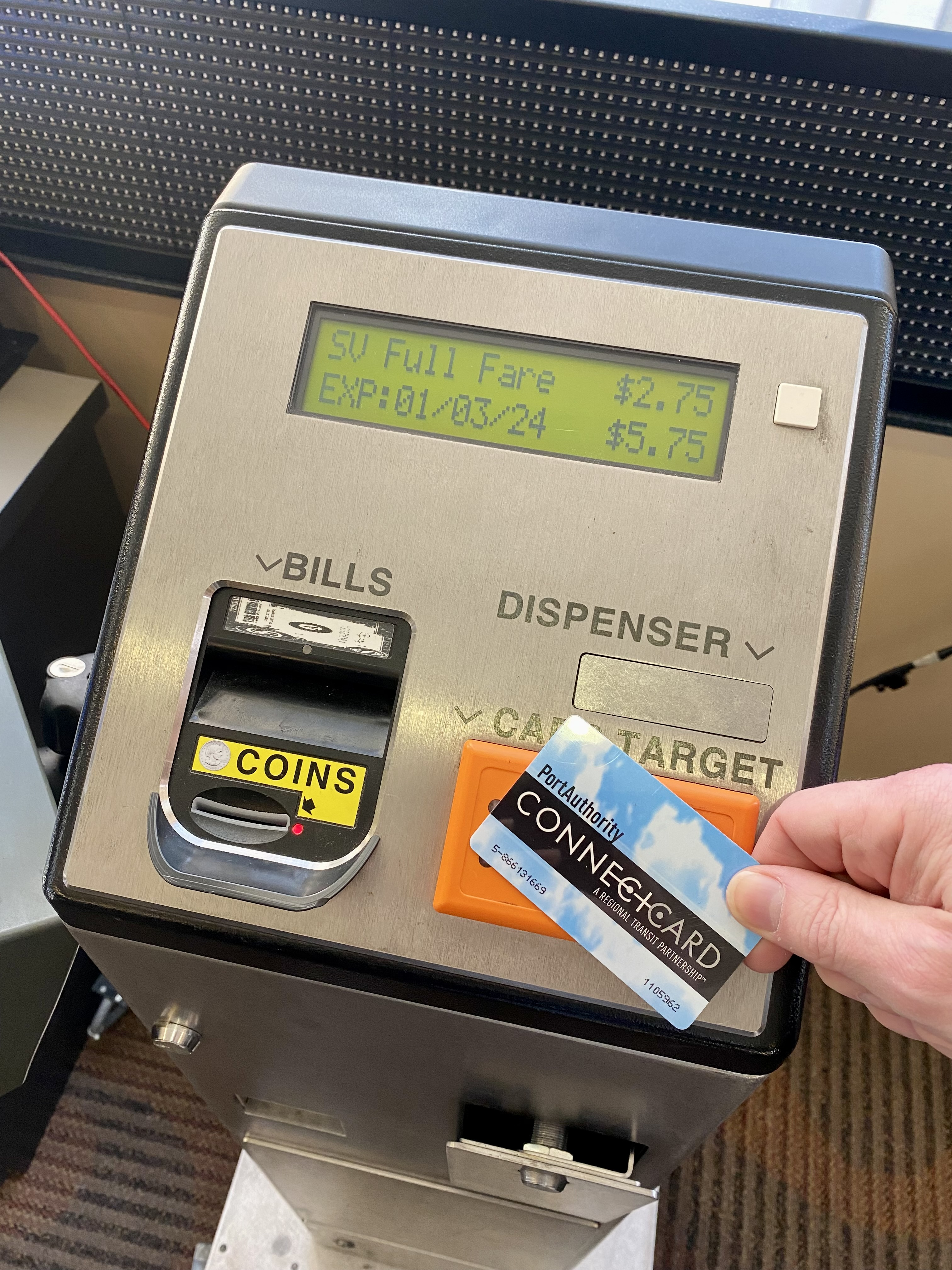
Paying For Your Ride
Unlike some systems in the country, Pittsburgh does not let you use your credit card to pay for a ride. However, don't fret because there are at least two very good apps that let you buy tickets online. The apps will give you a QR code that you can scan at the front of the bus when boarding - look for a little glass scanner on the side facing the windscreen.
PRT App
The official app of the Pittsburgh Regional Transit (PRT) authority. For buying tickets, this is a surprisingly decent app. It's quick to open and always reliable.
Transit App
This is the same app as the one above. You can also buy tickets on here.
Cash
Yes, you can pay with cash! However, there is no option to get any change back.
ConnectCard
This is PRT's official card for paying for transit. You can buy this online, at most T-stations, some Busway stops and perhaps at a Giant Eagle or two. But seriously, just use the apps. They are far more convenient and just as reliable.
Getting to the Airport
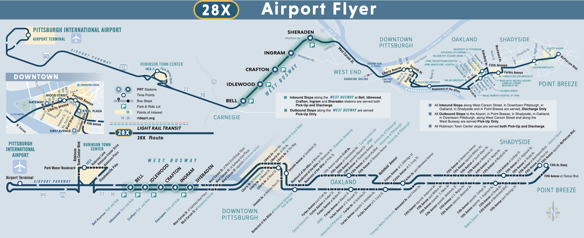
Catching a flight is the only time most people here take public transport, so I figured I'd give it its own section. If you want to get to and from the airport, there's only one option for you - the 28X bus. It picks people up in Shadyside, Oakland and Downtown, and goes to the Airport with a small detour at a Suburban IKEA (presumably so that you can get a vacation and new couch all in one go).
Use the Transit App (described above) to look at the position of the bus before you go out to the bus stop. If you're planning travel in advance, look up the schedule to figure out when the bus will approximately arrive (+/- 10 minutes in practice, with a 10% chance it never shows up). But hey, if you do manage to catch it on time, you get to save 50-100 bucks on an Uber!
The route is operated by a regular bus most of the time, so luggage space is limited. You can probably fit a large suitcase into the area reserved for wheelchairs if there's no one using it. Smaller carry-ons are always fine. The good news is that the bus is not usually crowded except for the handful of days when the colleges reopen after break.
Outlook
The outlook for public transit in Pittsburgh is bleak. The agency is reliant on state subsidies to operate, which means that it is vulnerable to political gridlock and shifting priorities. Unlike big cities like New York, most Pittsburghers are not dependent on public transit to get around or to avoid complete gridlock on the roads. In recent years, the work-from-home trend kickstarted by the pandemic has dealt a further blow to ridership. This means public transit is a nice-to-have for most people - not something that would change their vote.
To stave off big service cuts, PRT is transferring funding from capital projects to daily operations for the next few years. It remains to be seen if this can continue indefinitely - will the state rescue it, is this just pushing the inevitable into the future?
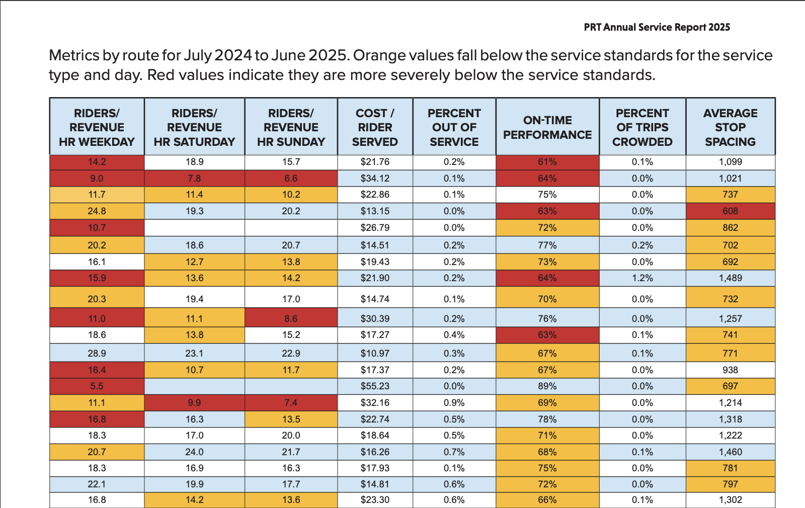
At its core, the fundamental issue is that outside of a few neighborhoods, Pittsburgh is not a very dense city. This makes it hard to run a profitable system without sacrificing reach or frequency. To reach far-flung neighborhoods, the agency has to sacrifice some service in the most dense neighborhoods, which in turn dissuades people in these central areas (the ideal target audience) from relying on public transit. Some of the less popular routes in the network cost upwards of $20 or $30 per rider, which is probably comparable to the operating costs of booking an Uber or Lyft ride for each passenger instead! The alternative, to cut these routes, is not very palatable either, since that would mean permanently stranding some people for whom this is the only way to get to their job or healthcare appointments.
In the near future, Pittsburgh will have to get creative and more efficient with its transportation network. Focusing on making some busy corridors more frequent, and redesigning routes to focus on transfers could help. Most people don't mind travelling slightly longer provided they are guaranteed a predictable commute time. Heck, perhaps it could replace expensive full-fledged buses on routes that run mostly empty with more efficient minibuses or minivans when the lifecycle of the current buses is up.
There is more reason to be hopeful when looking five to ten years into the future. The commoditization and scaling of autonomous driving will make the cost of operating a large taxi or bus fleet 20-40% cheaper. Who knows, perhaps the future could be a world where buses are replaced with dynamically routed driverless minivans that can pick up and drop off passengers at personalized stops along the way.